Over The Hill
I've spent a bit of time this week exploring some of the places on the other side of Winter Hill from where I live, hence the title, although, with the amount of cramp, shin splints and back pain I've suffered on my walks just lately, the title could be referring to something else.
The first set of images are from the hills around Turton Moor, which lies at the South end of Darwen Moor. I'd heard there were more examples of man's prehistoric activities up there, standing stones and such, but my googling research had turned out fruitless, so, as it was a nice day, I decided to head up there myself and take a look around the place, paying particular interest to two locations I'd spotted on the OS map, "Big Grey Stones" and "Hanging Stones", both sounded like they had the potential to be fine examples of not only megalithic structures, but the legendary flair for clever and witty names that we're world renowned for here in damp and boggy Lancashire.
As I was heading into unfamiliar territory, I didn't want to be bogged down with a big heavy camera, so I opted for the little X-T50 and my bag of XF primes. I'm sure I've weighed this combination and found it's actually heavier than the Z8+24-70 f/2.8S, but, psychologically at least, having something the size of an instamatic (remember those?) dangling from a wrist strap feels a lot less effort than carrying the blunt instrument in camera for that is the Z8, even if it needs the accompanying bag of half a dozen primes to equate to the 24-70. All of the following images were shot in the Acros+R B&W film sim. I did look to switch some of these to a colour sim during editing, but, for the most part at least, this felt detrimental to the images, so I've kept them in B&W and generally, didn't need to apply much in the way of editing either.
Lower Pasture Barn Farm
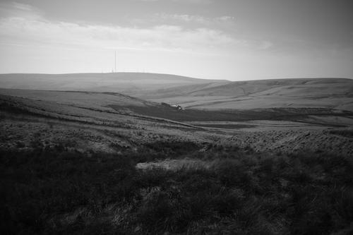
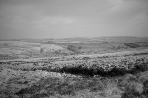
The walk began with an initial steep climb up to the level of the moor. Apparently this is about 300ft of ascent, but given the amount of grumbling my body did here, it felt like 3,000ft. On my way back down, I came across a number of young couples who'd given up because it was too steep before reaching the top, which made me feel a bit better about my poor effort. On the way up, I spotted this farm on the hillside below. As I moved up the hill, it shifted its relative position to the distant Winter Hill mast until it arrived at this arrangement as I neared the summit, which I felt made the best composition.
The impression this image gives, is of a remote farm in the middle of a moorland wilderness, but that's something of an illusion caused by the vantage point as a busy 'A' road runs past it slightly further down the hill, but out of sight from here.
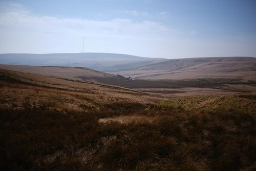
This is also one of the few images from the walk that I felt worked just as well in colour as it did in B&W, so here's that version for comparison. What do you reckon?
Acros The Moors (apologies for the bad pun)
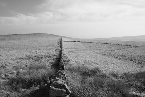
After gasping for breath resting briefly at the top of the hill, I set off along the moorland path that swings by Big Grey Stones and as I crested the moor, this was the view laid out before me. I think, at this point, I'd kind of slipped up.
A partial path leaves the main path heading more in the direction of the stones and I'd decided to follow that, but then it led onto what appeared to be the wrong side of a fence taking me away from where I'd intended to go, so, exercising my right to roam and being a complete idiot, I ignored this and instead remained on my current side of the fence and instead started to make my way up the steep slope, pushing through the long and tufted grass. I soon realised this was a mistake as the tufts of grass were nothing of the sort, I'd actually strayed into a hidden and seriously overgrown boulder field.
This is the kind of thing I'd often see at the top of a mountain in The Lake District, but without the grassy covering, so you could always see where you were putting your feet, here, the grass made the whole thing extremely dangerous, hiding gaps between the boulders that could easily trap a foot and break an ankle, so very soon I found myself cautiously heading back down the slope towards the safety of the fence, which you can see in the picture at the bottom left (the path being on the opposite side of this).
Running uphill to the right in the middle of the picture you can see another fence that eventually leads up to the Big Grey Stones. What I hadn't realised when I ignored the path crossing to the outside of the lower fence was that it crossed back to the inside again where the two fences met and that this whole area was fenced off because, well, it's bloody dangerous. It would help if the paths were shown on the OS maps, but many aren't.
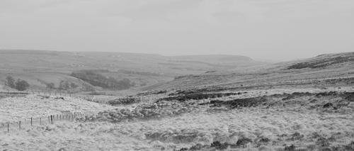
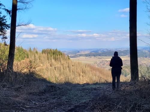
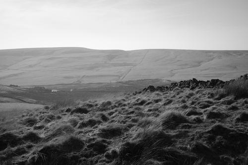
Moorland Vista
Another view looking across the moors, this time from a safer footing.
Big Grey Stones
I think it's fair to say they were on point when naming these. It's difficult to judge the scale, but that one on the top right is higher than my head (i.e. over 6ft) and just sat on top of the one beneath it. I was careful not to get too close.

Standing Stones?
After the excitement of the Big Grey Stones, I had high hopes as I trudged across the flat and boggy top of Turton Moor towards the Hanging Stones. The squishy ground beneath my feet threatened to swallow me at several points, but fortunately I managed to stay afloat. As I crossed the moors, I spotted a mysterious standing stone and made a beeline for it. As it turned out, there were several of these, all carefully placed in what seemed like a very straight line heading towards the Hanging Stones. Probably aligned to some celestial configuration? One even had mystic runes etched upon it in a lost language, although from a certain angle, I'd swear it looked like it said "BOUNDARY". Also, I didn't realise prehistoric man had reinforced concrete at their disposal. You live and you learn ;-)
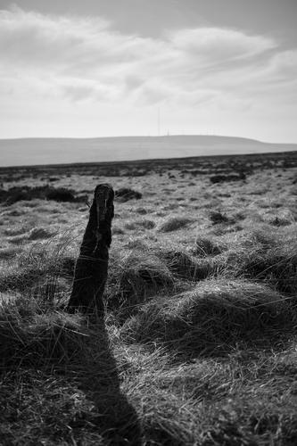
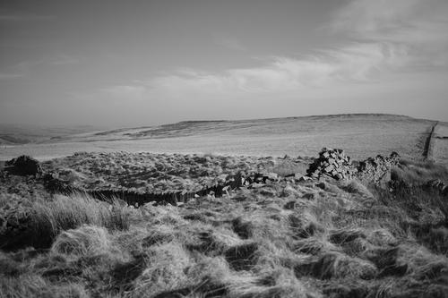
Hanging Stones
Eventually and unscathed, I made it across the moors to find this. The Hanging Stones are so named because they hang out of the edge of the hillside. At some point, the local authority thought it would be a good idea to construct a concrete post right in the middle of the outcrop, the remains of which you can see poking out of the top. Still, it was a nice spot to sit for a while, looking towards Winter Hill while enjoying the quietness of the location. As far as I can tell, neither this nor the Big Grey Stones are frequently visited, given the paths show little evidence of use.
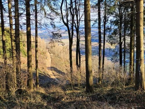
Great Hill
Great Hill was clearly visible as I followed the faint path that runs alongside the broken dry stone wall back towards where I'd initially set out.
Walls
This is looking back towards Hanging Stones, which emerge on the right hand edge of the hill to the left of the wall.
Lower Pasture Barn Farm - Again
Another view looking down towards the farm. In this shot I was more interested in the windswept grasses and wall in the foreground. The backlighting and B&W processing rendered these almost black straight out of camera, but I feel they give the image a more dramatic look.
Crumbling
If I stepped into the previous picture and turned 90 degrees to my left, this is the view I'd see, looking back across the crumbling walls. The hill on the horizon has the Big Grey Stones stacked on its left slope and the Hanging Stones poking out of the right.
And that was pretty much it for Turton Moor. No real signs of prehistoric human activities, just some big rocks and a few concrete posts, but it had been a nice walk that, once I'd overcome the shin splints, cramps and back ache near the beginning, I'd really enjoyed and will endeavour to go back again before too long.
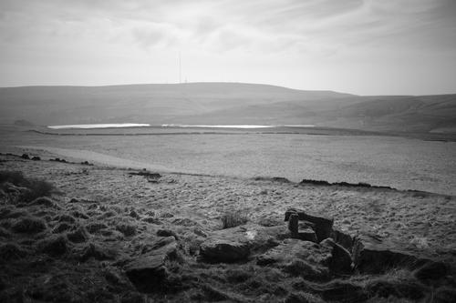
I was still keen to find this moorland evidence of prehistoric man that I'd heard of in the area, so I returned to my googling research and eventually discovered the stone circle on Cheetham Close. This was apparently a well preserved stone circle a few miles South East of Turton moor, or at least it was until a farmer took a sledgehammer to it in the 1820s. It's still shown on the OS maps, so I figured it would be worth a look.
It wasn't.
That farmer must have really gone to town as I couldn't find any trace of the stone circle. There are some large stones lying amongst the grass, but nothing that even appears to form a circle as far as I could tell. I was using my Garmin GPSMap with OS maps on it to place myself right in the middle of where the circle is drawn on the maps but I saw nothing.
There's a nice concrete trig point up there, but sadly little else that I could find. I did make my way down the far side of the hill to check out what appeared to be a cluster of rocks on the map, but when I got there and found nothing I took another look at the map and realised I'd scrambled my way down to a badly rendered ampersand.
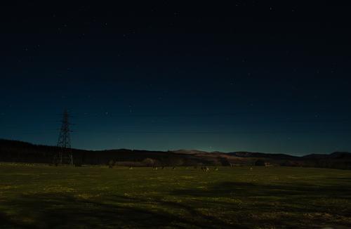
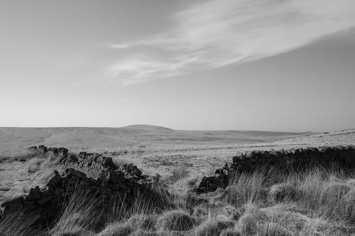
Still, it wasn't a complete waste of time and there were some quite nice views of Winter Hill and Anglezarke moor from the high vantage point as the sun was setting, although I did miss the best of the sunset as I was walking back to the car park in the middle of a Pine plantation and by all accounts it was a fantastic sunset.
On this occasion, I'd decided to take the Z8 along with the 24-70 f/2.8S and the 24-200 f/4-6.3, mainly because this was an evening walk and it was looking a bit overcast when I set out, so better low light capability would be a plus.
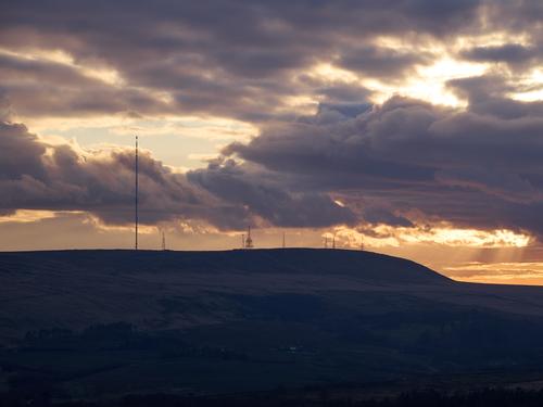
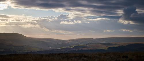
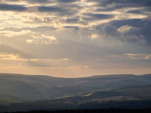
Winter Hill To Anglezarke Moor
Winter Hill is on the left, with Anglezarke moor dominating the middle and right of the horizon. The village of Belmont is neatly nestled in the centre of the image. When editing this I was wondering why I'd cut the main Winter Hill mast off on the left, but on reflection I think it was to cut the sun out of the frame and reduce flare. Usually I'd take a few shots like that anyway, but apparently not in this instance.
Belmont
A longer focal length look a Belmont. The atmosphere was being strongly lit here, reducing the contrast in the view of the village. There'd been a few seconds of much clearer and nicer light just before this, but I missed it swapping lenses and by the time I was ready to take the shot it looked like this. Still, I rather like it nonetheless.
Winter Hill
The full complement of masts and towers on top of Winter Hill.